Category:Maps
visual representation of a concept space; symbolic depiction emphasizing relationships between elements of some space, such as objects, regions, or themes | |||||
| Upload media | |||||
| Pronunciation audio | |||||
|---|---|---|---|---|---|
| Instance of | |||||
| Subclass of |
| ||||
| Part of |
| ||||
| Different from | |||||
| |||||
- (en) Map
- (an) Mapa
- (ar) خريطة
- (as) মানচিত্র
- (ast) Mapa
- (bg) Карта
- (bn) মানচিত্র
- (bs) Karta
- (ca) Plànol
- (cs) Mapa
- (cy) Map
- (da) Kort (geografi)
- (de) Karte (Kartografie)
- (eo) Mapo
- (es) Mapa
- (et) Kaart (kartograafia)
- (fa) نقشه
- (fi) Kartta
- (fr) Carte géographique
- (gan) 地圖
- (gl) Mapa
- (he) מפה
- (hi) मानचित्र
- (hr) Karta
- (hu) Térkép
- (id) Peta
- (is) Kort
- (it) Mappa
- (ja) 地図
- (ka) გეოგრაფიული რუკა
- (ko) 지도
- (la) Tabula geographica
- (lb) Landkaart
- (lt) Žemėlapis
- (ml) ഭൂപടം
- (ms) Peta
- (nl) Kaart (cartografie)
- (nn) Kart
- (no) Kart
- (oc) Mapa
- (pl) Mapa
- (pt) Mapa
- (ro) Hartă
- (ru) Географическая карта
- (sa) Хаарта
- (sco) Cairt
- (si) ple:Map
- (sk) Mapa
- (sl) Zemljevid
- (sq) Harta
- (sr) Карта (мапа)
- (su) Atlas
- (sv) Karta
- (sw) Ramani
- (ta) நிலப்படம்
- (tg) Харита
- (th) แผนที่
- (tl) Mapa
- (tr) Harita
- (uk) Географічна карта
- (vi) Bản đồ
- (yi) מאפע
- (zh) 地图
- (zh-classical) 地圖
- (zh-yue) 地圖
Before changing or adding maps, please read the brief guideline on the organizational schema About this Category developed during an eight month effort by a working group in 2007–2008.
- See also maps needing categories in Category:Unidentified maps
- See also these related categories: (These categories may contain more maps. Please categorize them in map categories.)
- Category:Cartography – for map symbols, projections, etc.
- Category:Demography
- Category:Geography
- Category:Aerial photographs
- Category:Satellite pictures
- Category:Astronomical maps – maps and star charts
- Category:Cartographic reliefs for models of landscape profiles
Resources:
Subcategories
This category has the following 26 subcategories, out of 26 total.
Pages in category "Maps"
The following 4 pages are in this category, out of 4 total.
Media in category "Maps"
The following 66 files are in this category, out of 66 total.
-
1928 Map of Phnom Penh.jpg 3,255 × 5,000; 10.05 MB
-
2024 Map of electric rail transportation in Greater Cairo v2.png 8,448 × 4,248; 1.67 MB
-
2033 Virginia election (fictional).svg 810 × 358; 104 KB
-
2040 US election (fictional).svg 1,020 × 593; 32 KB
-
Bilboko barrutietan Begoñako Errepublika.svg 2,090 × 2,027; 62 KB
-
Europe map without romania.jpg 2,484 × 2,933; 2.88 MB
-
Greece (Megali idea borders) and Romania.png 533 × 523; 13 KB
-
Karte Montego.png 1,136 × 573; 361 KB
-
Karte WVG-Gebiet.jpg 1,607 × 791; 181 KB
-
Kartgrafik förslag i den danska infrastrukturplanen (DK) 20210505 (51161938480).jpg 4,465 × 4,062; 1.95 MB
-
Kartgrafik förslag i den danska infrastrukturplanen 20210416 (51127090606).jpg 3,676 × 3,642; 2.12 MB
-
Kartgrafik förslag i den danska infrastrukturplanen 20210416 (51127148029).jpg 3,663 × 3,661; 2.07 MB
-
Kartgrafik förslag i den danska infrastrukturplanen 20210505 (51158893222).jpg 4,437 × 4,045; 1.98 MB
-
Kartographische Lage Primank.jpg 2,529 × 2,704; 2.12 MB
-
Kartographische Lage von Primank..jpg 3,024 × 4,032; 4.92 MB
-
Kastelle von Passau 1.-5. Jhdt..jpg 1,138 × 821; 280 KB
-
Kastiel beketfa.jpg 391 × 430; 89 KB
-
Kel pengasinan.svg 1,068 × 744; 333 KB
-
Kengtung tsp in Kengtung district.svg 584 × 508; 70 KB
-
Kentucky Congressional Districts (1935-2021).gif 837 × 387; 30.63 MB
-
Kerinci Language Map.svg 245 × 210; 875 KB
-
Khandesh1398.jpg 1,971 × 2,496; 697 KB
-
Kharovsky District, Vologda Oblast.jpg 693 × 570; 186 KB
-
Khedivate's aussa sultanate 1870s - 80s.png 550 × 440; 143 KB
-
Khera Dabar.jpg 695 × 372; 56 KB
-
Kherson kazennuy sad (1864).jpg 2,788 × 3,691; 14.86 MB
-
Kiesel Standorte Deutschland.jpg 2,802 × 2,100; 787 KB
-
Kiesel Standorte Europa.jpg 2,800 × 2,100; 1.08 MB
-
Kinshasa Districts and Communes (2021).svg 512 × 407; 1.75 MB
-
Kinshasa Districts Communes and Quarters (2021).svg 512 × 407; 1.75 MB
-
Kırkkilise Muharebesi Osmanlı Harekat Planı.jpg 469 × 322; 48 KB
-
Kovalam plan.jpg 1,100 × 895; 190 KB
-
KSA Main Road 15.png 720 × 599; 95 KB
-
Kurk yolu.png 650 × 495; 113 KB
-
Kurmanchal kingdom,a medieval himalayan kingdom.jpg 705 × 597; 265 KB
-
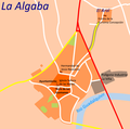
La Algaba.png 658 × 650; 74 KB
-
La Baye de l'Isle de Prince LCCN2003662094.jpg 1,536 × 1,038; 388 KB
-
La Baye du Cap de Bonne Esperance LCCN2004667641.jpg 1,536 × 1,064; 214 KB
-
Labuan-malaisie-1000px.png 1,000 × 561; 179 KB
-
Lageplan-1765.jpg 804 × 844; 311 KB
-
Lageplan-1789.jpg 1,193 × 741; 318 KB
-
Lamaru subdistrict.jpg 2,048 × 2,048; 117 KB
-
Larrea tridentata range map.jpg 536 × 576; 132 KB
-
Le golfe de corinthe.png 630 × 454; 361 KB
-
Le Lerzy Cassini.jpg 939 × 1,359; 1.22 MB
-
Le territoire de la commune de Terrenoire.jpg 811 × 898; 522 KB
-
Leaf River Herd range.png 767 × 996; 273 KB
-
Legenda Turkse Raad.png 1,918 × 932; 116 KB
-
Leipheim Stadtkarte.png 3,712 × 3,840; 928 KB
-
Lekki Masterplan showing Gracefield Island.jpg 544 × 384; 45 KB
-
Localización de Sosote en la Parroquia Sosote.jpg 610 × 705; 109 KB
-
Map of the Hammersmith Sea.png 2,332 × 860; 52 KB
-
Mapa de Denisia.png 2,184 × 2,184; 841 KB
-
Range Galeus poli.jpg 4,728 × 2,703; 796 KB
-
Regional Security System Map.png 5,500 × 6,000; 1.87 MB
-
Regions of Pervomaisk for Wikivoyage.pdf 1,275 × 1,650; 39 KB
-
Sites sondés par Louis Jourdain.jpg 929 × 650; 188 KB
-
StKataev.png 1,336 × 678; 509 KB
-
Territory of the Mullagori Tribe in Nangarhar Province, Afghanistan.jpg 967 × 611; 174 KB
-
TracesintheEmptyQuarter.jpg 1,760 × 871; 419 KB
-
خريطه القبائل الاردنيه إقليم البلقاء.png 1,809 × 1,302; 2.55 MB
-
قبائل جذام.jpg 1,039 × 732; 468 KB
-
گوندێ چێ لسەر نەخشەی.jpg 1,080 × 1,960; 513 KB
_ESA23162625.png/230px-Topographic_map_of_Jezero_crater_and_surrounds_(annotated)_ESA23162625.png)


.svg/120px-2033_Virginia_election_(fictional).svg.png)
.svg/120px-2040_US_election_(fictional).svg.png)


_and_Romania.png/120px-Greece_(Megali_idea_borders)_and_Romania.png)


_20210505_(51161938480).jpg/120px-Kartgrafik_förslag_i_den_danska_infrastrukturplanen_(DK)_20210505_(51161938480).jpg)
.jpg/120px-Kartgrafik_förslag_i_den_danska_infrastrukturplanen_20210416_(51127090606).jpg)
.jpg/120px-Kartgrafik_förslag_i_den_danska_infrastrukturplanen_20210416_(51127148029).jpg)
.jpg/120px-Kartgrafik_förslag_i_den_danska_infrastrukturplanen_20210505_(51158893222).jpg)


.gif/120px-Kentucky_Congressional_Districts_(1935-2021).gif)


.jpg/91px-Kherson_kazennuy_sad_(1864).jpg)


.svg/120px-Kinshasa_Districts_and_Communes_(2021).svg.png)
.svg/120px-Kinshasa_Districts_Communes_and_Quarters_(2021).svg.png)


